
District of Kengerli
Total territory [sq.km] |
704,89 |
Total number of population [th. people] |
33,5 |
Villages |
10 |
Settlements |
1 |
Municipalities |
9 |
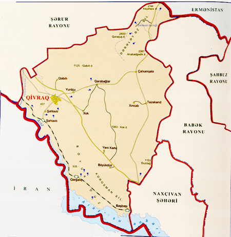 The district of Kengerli is located between the districts of Babek and Sharur. The southern part of the district is bordered by Iran, the northern - by Armenia. The landscape of the district is predominantly mountainous; it is located on the Daralayaz Plateau.
The climate, like in the rest of the autonomous republic, is strongly continental; it is very hot in summer and chilling in winter. On the territory of the district runs the Araz River that flows along the border between Azerbaijan and Iran.
Mountainous landscape, climatic conditions and lack of small rivers underlay the features of the indigenous fauna, which is represented largely by semidesert and mountainous species (bushes, herbage and scarce trees).
This is an agricultural district with advanced tobacco, cine, grain, vegetable and melon growing.
Like the rest of Nakhchivan Autonomous Republic, there are many ancient monuments, evidencing that the land was inhabited in earliest times: the Chilkhangala mounds, the Gazma Cave and the ancient settlements of Galajig, Govurgala, Damlama, Gulamtepe and Balatepe.
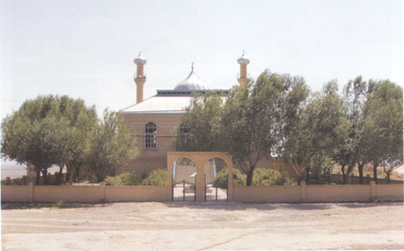
There are also newer monuments - the Jami Mosque (18th century) in the village of Khok, a mosque of the 18th century and a bath of the 19th century in the village of Shahtakhty.
 The village of Givrag is the administrative center of the district. It was founded only in 2004. Givrag is located on the Nakhchivan-Sharur highway, 30 km from the capital (Nakhchivan) and 6 km from the Araz River.