
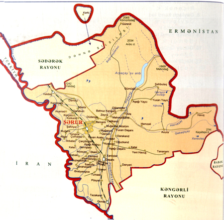
District of Sharur
Total territory [sq. km] |
872,62 |
Total number of population [th. people] |
113,0 |
Cities |
1 |
Villages |
65 |
Municipalities |
52 |
 Sharur is one of the most ancient and the largest settlements of the Autonomous Republic of Nakhchivan. The favorable geographical position of Sharur created conditions for the settlement of people in the ancient times. The researches showed that the people settled in the area in the late glacial period. The territory of Sharur with its full water rivers, fertile soils were favorable for the development of plant-growing.
The historical researches defined the settlement of the people in Sharur before Christ. The archeological excavations on the territory of Sharur which is mentioned as Sharik in the epos of Dede Gorgud dating back to the period 1300 ago revealed the settlement and burial places of the Neolithic, Bronze Age as well as Antique period. The settlement Oghlangaya covering an area of 40 hectares of the Garatepe Mountain of the region dates back to the 2nd-1st millenniums B.C.
The region accounts for a number of archeological monuments and settlements rich in the patterns of material culture reflecting the activity and lifestyle of ancient people. These are the ancient, settlement, towers, cemeteries, Kurgans and architectural monuments. The researches of 1980-1990 revealed the cultural remnants of the dug cave of the Stone Age including a great many of instruments made of stone and wine-tree. The monuments of the mid Bronze age was revealed in the Araz river, Arpachay and its branches (Shortepe, Khelej mountain, Kultepe, Jennettepe and others).