
District of Ordubad
Total territory [sq. km] |
978,99 |
Total number of population [th. people] |
50,7 |
Cities |
1 |
Villages |
43 |
Settlements |
3 |
Municipalities |
27 |
 Ordubad is a region with an ancient history and the specific national and moral values. It is located on the foothills of the Gapijig of the Minor Caucasus. Mountains dominate the landscape; its smaller part consists of foothill areas and 5-5 % -of the flat regions. It has extremely rich flora and fauna. The settlement is mostly located on the foothill area and has the sufficient irrigation and fresh water reserves.
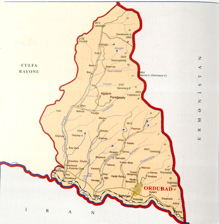
It borders on Iran in the south, Armenia in the north and west and Julfa region in the east and covers an area of 972 km2.
The establishment of the city has not yet been defined exactly. Yet this area is considered one of the most ancient human settlements in the world and the place of the humanity formation. The name of Ordubad is mentioned for the first time in the written sources of the 5th century. The Gemigaya mountain considered one of the great pantheons of the ancient world is also located in Ordubad. The mountain carvings and the settlements locating here enable to trace back the cultural development and the lifestyle of the ancient population settled on the territory of Ordubad in the 7th-1st B.C. The settlement and necropolises rich in the remnants of culture of the 2nd-1st millenniums B.C exist on the territory of such settlements of Ordubad as Sabirkend, Plovdagh and Kharaba Gilan. That proves Ordubad to be 7 thousand years of age.
 In the early 18th century Ordubad was part of the Sefevi Empire. In 1724 Ordubad was annexed by the Osmanly Empire and later placed under Nadir shah.